mobile View, to the German Version tap the flag


- Autonomous Country within the Netherlands
- possession of the Netherlands
- to 2010 Teil der Niederländischen Antillen
- other names: Papiamento: Kòrsou, German: Curassao
• Flags
• Historical Flags
• Meaning/Origin of the Flag
• Map
• Numbers and Facts
• History
• Origin of the Country's Name
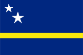
Flag of Curaçao,
ratio = 2:3,
Source, by: Flags of the World,
Corel Draw 4


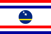
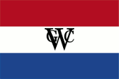
Flag for the Governor of Curaçao,
ratio = 2:3,
Source, by: Flags of the World


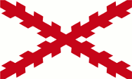
1524–1634,
The island belongs to the Spanish sphere of influence,
Source, by: Wikipedia (EN)

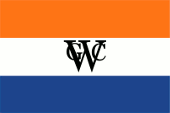
1634–1660,
Flag of the Dutch West India Company,
Source, by: Wikipedia (EN)
1660–1791,
Flag of the Dutch West India Company,
Source, by: Wikipedia (EN)
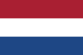
1791–1984,
Flag of the Netherlands
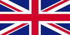
1800–1803, 1807–1816,
Flag of United Kingdom
The flag of Curaçao was adoped on 2nd of July in 1984. It shows three different wide stripes in blue, yellow and blue, resp. is single-coloured blue with an uninterrupted slender yellow stripe. In the upper staff quadrant two different large white five-pointed stars. The blue stands for the Caribbean Sea, yellow for the sun and the both stars for the islands Curaçao and Little Curaçao. Blue is also the colour of the faithfulness and symbolizes the closeness to the Dutch crown.
Source: Flaggen Enzyklopädie
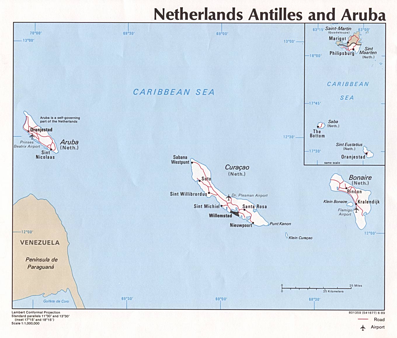
Location:
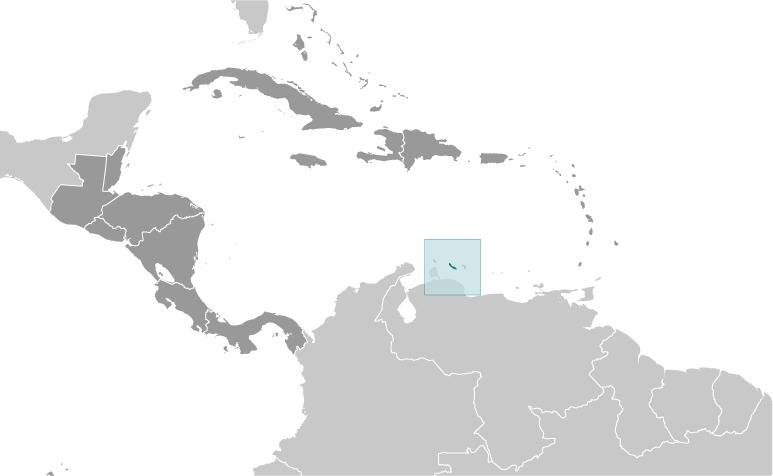
Source: CIA World Factbook
enlarge: click here
Source: Free Maps www.mapcruzin.com
Map of the country:
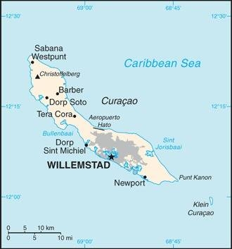
Source: CIA World Factbook
Area: 171 sq.mi.
Inhabitants: 160.337 (2017)
Density of Population: 935 inh./sq.mi.
Capital: Willemstad, 140.000 inh. (2008)
official Languages: Dutch, Papiamento, English
other Languages: Spanish
Currency (since 1st of January 2012): 1 Netherlands Antilles Florin (NAFl.) = 100 Cent
Currency (to 31st of December 2011): 1 Caribbean Florin (CMG, CMf) = 100 Cent
Time Zone: GMT – 4 h
Source: Wikipedia (D)
26th of July in 1499 · the Spanish seafarer Alonso de Ojeda discovers today's Curaçao, and names it Isla de los Gigantes (Island of Giants), and appropriates the island for Spain
1502 · the island comes to the Spanish Province of New Andalusia
1524 · the island comes to the Spanish Viceroyalty of New Spain
21st of August in 1634 · the Dutch conquer the island, it comes under the administration of the Dutch West India Company (to 1791)
1648 · Spain recognizes the Dutch possession of the islands of Curaçao, Aruba and Bonaire
1800–1803 · Curaçao is occupied by British troops
1807–1816 · Curaçao is occupied by British troops
1828 · Curaçao, Aruba, Bonaire, Saba, Sint Eustatius, Sint Maarten, Dutch Guyana (Surinam) become summarized as the Dutch West India under a Governor General, the Governor of Dutch Guyana
27th of January in 1848 · Curaçao, Aruba, Bonaire, Saba, Sint Eustatius and Sint Maarten become summarized and a separate colony under the name "Curaçao and Dependencies"
20th of September in 1948 · renaming of "Curaçao and Dependencies" in "Netherlands Antilles"
29th of December in 1954 · the Netherlands Antilles become an autonomous part of the Netherlands
1st of January in 1986 · Aruba leaves the association of the Netherlands Antilles
19th of November in 1993 · a referendum on Curaçao causes the remain within the Netherlands Antilles
15th of May in 2009 · a referendum on Curaçao causes a special status within the Netherlands Antilles
10th of October in 2010 · Netherlands Antilles become dissolved administratively – Curaçao and Sint Maarten become an autonomous country within the Netherlands (like Aruba in 1986), Bonaire, Sint Eustatius and Saba become special municipalities of the Netherlands, but don't belong to any province
Source: World Statesmen,
Meyers Konversationslexikon via RetroBib Retrobibliothek
The name "Curaçao" has its roots in the Portugese word "Coração" what means "heart". The naming is a result of catholic inspiration in the sense of "Holy Heart", what means the heart of Jesus Christ.
Source: Handbuch der geographischen Namen