mobile View, to the German Version tap the flag


- Mayotte and Dependences
- possession of France
- overseas department, ultraperipheral part of France and the EU
- own name: Département et région d’outre-mer de la Mayotte
• Flags
• historical Flag
• unofficial Flag
• Meaning/Origin of the Flag
• Coat of Arms
• Meaning/Origin of the Coat of Arms
• Map
• Numbers and Facts
• History
• Origin of the Country's Name

Flag of France,
ratio = 2:3,
Source, by: Corel Draw 4


since 2011,
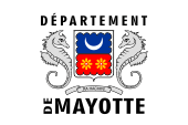
Flag of the Department,
ratio = 2:3,
Source, by: World Statesmen,
Flag of Mayotte (local).svg]: from the xrmap flag collection 2.9.derivative work: Xfigpower (pssst), Public domain, via Wikimedia Commons


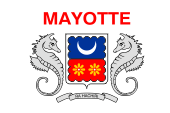
1982–2011,
Flag of the General Council,
ratio = 2:3,
Source, by: World Statesmen,
Flag of Mayotte (local).svg]: from the xrmap flag collection 2.9.derivative work: Xfigpower (pssst), Public domain, via Wikimedia Commons
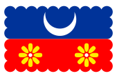
unofficial crest flag,
doubtful
All French colonies had no own flag over a long period. It had to be hoisted the French tricolor. This in principle usual until today. The status of the colonies changed over the years. Some of them are now overseas departments, and thus a ultraperipheric part of France and of the EU; others are overseas communities, autonomous, and not a part of France or the EU. Overseas departments belong – in contrast to the departments of the motherland – to no administrative region of France, they are a separate region. The territorial entity has therefore officially to use the flag of France. However, the General Council as the highest elected collegial body of a French Department and the Regional Council as the highest elected collegial body of a French Region can have their own flags. These flags of departments and regions, however, have oftenly the appearance of company flags with logos or even stylized images, appear carelessly, ahistorical, technocratic and modernist, because in the strictly centralist France is avoided any regionalism or even a historical subscription. Because of that these logo flags of regions are unpopular and are rarely used. The General Council of the Department (as an administrative body) had its own flag since 1982. That flag was displaced in 2011 by a new flag representing the department as a territorial collectivity. The flag of the General Council showed the coat of arms of Mayotte with the country's name in red above it on a white bunting. The flag of the department is similar, but the inscription is black and shows the words "DÉPARTEMENT" above the coat of arms, and below "DE MAYOTTE". But, there exist probably, for local and tourist purposes – like usual in almost all French possessions - the famous and popular crest flags, where the image of the Coat of Arms of the country is transferred to a bunting. However, that is not certain in the case of Mayotte. Such images can be found on the Internet, including modifications, but the actual use is questionable.
Source:
Wikipedia (RF),
World Statesmen,
Volker Preuß
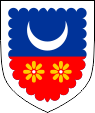
Escutcheon of Mayotte,
Source, by:
Wikipedia (EN), Flag of Mayotte (local).svg]: from the xrmap flag collection 2.9.derivative work: Xfigpower (pssst), Public domain, via Wikimedia Commons
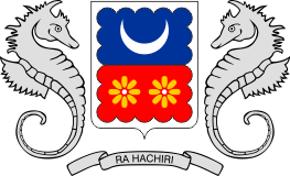
Coat of arms of Mayotte,
Source, by:
Wikipedia (EN), Flag of Mayotte (local).svg]: from the xrmap flag collection 2.9.derivative work: Xfigpower (pssst), Public domain, via Wikimedia Commons
The coat of arms of Mayotte was introduced in 1982. It is a silvery invected-bordered crest and divided from blue and red divided shield. Above, a silvery, lying moon and below two golden six-petalled flowers. Supporters are two silvery seahorses. Under the coat of arms the motto on a silvery ribbon with black capital letters "RA HACHIRI" ("We are vigilant").
Source:
Wikipedia (EN)
Position of the Comoros:
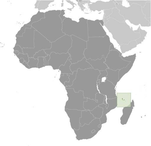
Source: CIA World Factbook
Comoros:
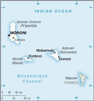
Source: CIA World Factbook
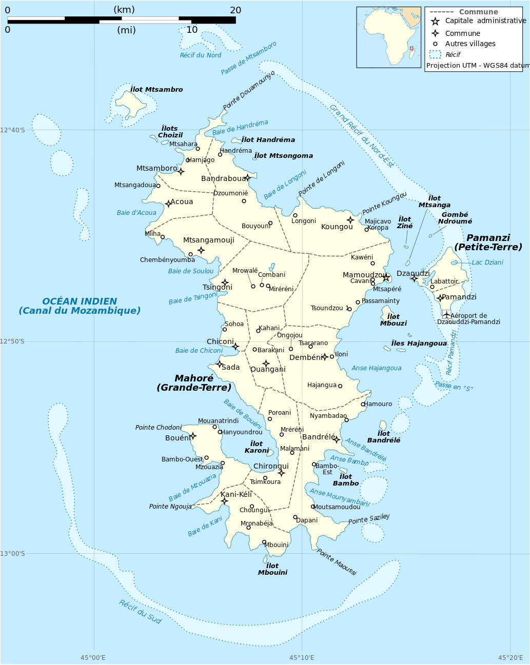
Landkarte/map, Source: Rémi Kaupp, CC BY-SA 4.0, via Wikimedia Commons,
zum Vergrößern klicken, click to enlarge
Area: 141 square miles
Inhabitants: 256.518 (2017)
Religions: 98% Muslim
Density of Population: 1.815 inh./sq.mi.
Capital: Mamoudzou, 71.437 inh. (2017), (to 1977 Dzaoudzi 17.831 inh.)
official Language: French
other Languages: Mahoric, Suaheli
Currency: 1 Euro (€) = 100 Cent
Time Zone: GMT + 3 h
Source:
Wikipedia (D)
1416 · Arabian conquest of Mayotte
ca. 1500 · Portugese conquest of Mayotte
1506 · Mayotte belongs to the Sultanate of Comoros
25.08.1841 · Mayotte is a French colony
1886 · France declares the other Comoros Islands to a protectorate
1912 · establishing of the French Colony of the Comoros
1946 · the Comoros become a French overseas territory
1974 · referendum on Mayotte about the independence of the Comoros, the majority of the Mahorais rejects the independence
1975 · the Comoros declare themself for independent and power claims on Mayotte
1976 · referendum on Mayotte about the independence, the majority of the Mahorais rejects the independence again
1985 · a refugee torrent comes from the Comoros on the island
1991 · a refugee torrent comes from the Comoros on the island
2009 · referendum, Mayotte has to become an overseas department and an overseas region
2011 · Mayotte becomes an overseas department and an overseas region, whereby the General Council and Regional Council are merged, the country becomes a "Collectivité territoriale unique"
Source:
Wikipedia (D),
Volker Preuß
The word "Mayotte" is the French name for the local name "Maoré". This name for this island came into beeing ca. in 1500, because an independent state, who was called "Maoré" or "Mawuti", had emerged here. The names come from the Arabic language and are intended to mean "Island of the Dead" or "Island of Death". The inhabitants call themselves "Mahorais".
Source:
Wikipedia (D)