Süddakota

  • Süddakota (Süd Dakota)
  • Bundesstaat der USA
  • South Dakota
  • federal state of the USA
Übersicht – Contents:


Flagge – Flag:


Staatsflagge – state flag,
Seitenverhältnis – ratio = 3:5

hoch/up


historische Flaggen – historical Flags:


1909–1963,
Staatsflagge – state flag,
Seitenverhältnis – ratio = 3:5,
nach/by: FOTW


1963–1992,
Staatsflagge – state flag,
Seitenverhältnis – ratio = 3:5,
nach/by: FOTW

hoch/up


Bedeutung/Ursprung der Flagge: Meaning/Origin of the Flag:

Die heutige Flagge von Süddakota wurde am 01.07.1992 eingeführt. Sie zeigt ein einfarbig hellblaues Grundtuch und in der Mitte das Siegel des Staates auf einer goldenen Sonne. Um das Siegel eine goldene Inschrift: "South Dakota – The Mount Rushmore State"

The current flag of South Dakota was introduced on 1st of July in 1992. It shows a light blue colored bunting and in the middle the seal of the state placed on a golden sun. Around the seal a golden inscription: "South Dakota – The Mount Rushmore State"

Das Siegel stammt aus dem Jahre 1889 und zeigt eine Landschaft mit dem Fluss Missouri, einen Dampfer (Handel und Transport), einem Hochofen (Bergbau und Industrie), eine Herde von Rindern (Viehzucht), Bäume (Forstwirtschaft) und im Vordergrund einen pflügenden Bauern (Landwirtschaft). Im oberen Bereich des Siegels befindet sich ein Spruchband mit dem Motto des Landes: "Under God the People Rule => "Unter Gott herrschen die Menschen"

The seal dates from 1889 and shows a landscape with the Missouri River, a steamer (trade and transport), a blast furnace (mining and industry), a herd of cattle (livestock), trees (forestry) and one farmer plowing (agriculture). Located in the upper area of the seal is a banner with the motto of the country: "Under God the People Rule".

Die erste Staatsflagge wurde am 01.07.1909 eingeführt. Sie zeigte ein einfarbig hellblaues Grundtuch und in der Mitte eine goldenen Sonne. Um die Sonne eine goldene Inschrift: "South Dakota – The Sunshine State". Am 11.03.1963 wurde das Siegel des States in die Mitte der Sonne platziert, und am 01.07.1992 wurde die Inschrift um das Wappen auf die heutige Version abgeändert.

The first state flag was adopted on 1st of July in 1909. It showed a plain light blue nunting and in the middle, a golden sun. Around the sun is placed a golden inscription: "South Dakota – The Sunshine State". On 11th of March in 1963 the seal of the States was placed in the middle of the sun, and on 1st of July in 1992 the inscription was changed to the today's version.


hoch/up


Zahlen und Fakten – Numbers and Facts:
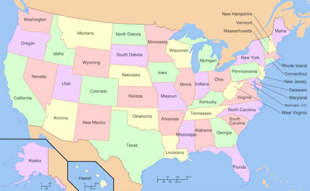
  • Fläche:
    199 731 km²
  • Area:
    77 116 square miles
  • Einwohner:
    782 000 (2006)
    davon
    87% Europäer (davon 40% Deutsche)
    9% Indianer
    2% Hispanics
    1% Asiaten
  • Inhabitants:
    782 000 (2006)
    thereof
    87% Europeans (thereof 40% Germans)
    9% native Indian
    2% Hispanics
    1% Asian
  • Bevölkerungsdichte:
    4 Ew./km²
  • Density of Population:
    10 inh./sq.mi.
  • Hauptstadt:
    Pierre
    14 000 Ew.
  • Capital:
    Pierre
    14 000 inh.
  • Amtssprache:
    Englisch
  • official Language:
    English
  • Währung:
    1 US-Dollar (USD, $) = 100 Cent
  • Currency:
    1 US-Dollar (USD, $) = 100 Cent
  • Zeitzone:
    MEZ – 8 bis – 7 h
  • Time Zone:
    GMT – 7 to – 6 h
hoch/up


Landkarte der Bundesstaaten der USA – Map of the federal states of the USA:
interaktiv – interactive


Quelle/Source: Printyble Maps

hoch/up


Geschichte:

ca. 9000 v.Chr.
· Besiedlung durch Indianer (Siuox)
1738–1742 · eine französische Expeditionen unter Pierre Gaultier de Varennes et de La Vérendrye erforscht das Land, später geringfügige französische Kolonisierung, zu Französisch-Louisiana
1763 · Frieden von Paris, Frankreich muss seine Kolonie Louisiana an Spanien und Großbritannien abtreten, riesige Gebiete bis zum Mississippi (unter anderem das heutige Nord- und Süddakota) werden Spanischer Besitz
01.10.1800 · Frieden von San Ildefonso, Spanien muss seine Louisiana-Territorien an Frankreich zurückgeben und sich auf die Grenzen von 1763 zurückziehen
1803 · Frankreich verkauft Louisiana an die USA
1804–1806 · die US-amerikanische Lewis-und-Clark-Expedition durchstreift das Gebiet
26.03.1804 · das heutige Süddakota wird Teil des Orleans-Territoriums
07.12.1812 · das heutige Süddakota wird Teil des Missouri-Territoriums
1838–1846 · die Gebiete östlich des Missouri gehören zum Iowa-Territorium
1849–1858 · die Gebiete östlich des Missouri gehören zum Minnesota-Territorium
1854–1861 · die Gebiete westlich des Missouri gehören zum Nebraska-Territorium
02.03.1861 · Gründung des Dakota-Territoriums, Hauptstadt Yankton
1863 · Indianerkrieg
1872 · Gründung von Edwinton (das heutige Bismarck)
1873 · Umbennung von Edwinton in Bismarck, zu Ehren des deutschen Reichskanzlers
1881 · erste Teilungspläne für das Dakota-Territorium
1883 · Bismarck wird Hauptstadt des Dakota-Territoriums
02.11.1889 · Süddakota wird 40. Bundesstaat der USA, Hauptstadt: Pierre
29.12.1890 · Lakota-Massaker der US-Kavallerie bei Wounded Knee


hoch/up


History:


about 9000 B.C.
· Settlement by Indians (Siuox)
1738–1742 · a French expedition under Pierre Gaultier de Varennes et de La Vérendrye explores the land, and later insignificant French colonization, to French-Louisiana
1763 · Peace of Paris, France has to cede the Louisiana Colony to Spain and Britain, large areas (including present-day North and South Dakota) become Spanish possession
1st of October 1800 · Treaty of San Ildefonso, Spain has to cede back the Louisiana Territory to France and has to withdraw to the borders of 1763
1803 · France sells Louisiana to the USA
1804–1806 · the US-american Lewis and Clark Expedition ranges the area
26th of March 1804 · today's South Dakota is part of the Orleans Territory
7th of December 1812 · today's South Dakota is part of the Missouri Territory
1838–1846 · the areas east of the Missouri River are part of the Iowa Territory
1849–1858 · the areas east of the Missouri River are part of the Minnesota Territory
1854–1861 · the areas west of the Missouri River are part of the Nebraska Territory
2nd of March 1861 · founding of the Dakota Territory, capital is Yankton
1863 · Indian War
1872 · founding of Edwinton (today's Bismarck)
1873 · renaming of Edwinton in Bismarck, in honor of the German Chancellor
1881 · first division plans for the Dakota Territory
1883 · Bismarck becomes the capital of the Dakota Territory
2nd of November 1889 · South Dakota becomes the 40th state of the USA, capital: Pierre
29th of December 1890 · Lakota massacre of U.S. Cavalry at Wounded Knee


hoch/up


Ursprung des Landesnamens: Origin of the Country's Name:

Der Name "Dakota" stammt aus dem Wortschatz der Sioux-Indianer. Er bezeichnete den östlichsten der drei Sioux-Stämme der Region. Die anderen beiden Stämme waren die Nakota und die Lakota. Dakota heißt "Freund" oder "Verbündeter".
The name "Dakota" comes from the vocabulary of the Sioux Indians. It described the easternmost of the three Sioux tribes in the region. The other two tribes had been the Nakota and the Lakota. Dakota means "friend" or "ally".

hoch/up


Zur Startseite hier klicken